
Flat-Earth-distance (Плоскозёмное расстояние)
v1.3 Updated Oct 7, 2022 41.36KiB
⚠️Not updated in over 2 years
Description
Объяснение расчётов (Используйте "линейку".)
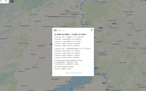
A,B,C - стороны прямоугольного треугольника.
A - от Северного полюса до Точки.
B - от Точки до Нулевого меридиана (под углом 90°).
C - от пересечения B и Нулевого меридиана до Северного полюса.
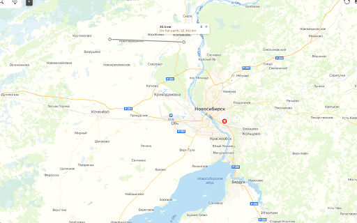
X и Y - координаты на виртуальной "карте Мира" (азимутальная проекция) размером 40000 км, нулевая отметка в верхнем левом углу.
Если "x,y" координаты Северного полюса "20000,20000", X и Y Точки расчитываются исходя из их положения относительно Северного полюса.
Вычитая X и Y двух Точек, получаем треугольник, гипотенуза которого является расстоянием между Точками.
Explanation of the calculations (Use the "ruler" tool.)
A,B,C are the sides of a right triangle.
A - from the North Pole to the Point.
B - from the Point to the Prime Meridian (at an 90° angle).
C - from the intersection of B and the Prime Meridian to the North Pole.
X and Y - coordinates on the virtual "world map" (azimuthal projection) with the size of 40,000 km, the zero mark in the upper-left corner.
If the "x,y" coordinates of the North Pole are "20000,20000", the X and Y of the Points are calculated based on their position relative to the North Pole.
Subtracting the X and Y of the two points, we get a triangle whose hypotenuse is the distance between the points.
Reviews
Loading reviews...
Details
| Version | 1.3 |
| Updated | Oct 7, 2022 |
| Size | 41.36KiB |
| First Seen | Mar 26, 2026 |
More by Michael Osincev


Popular in social

Cisco Webex Extension
by cisco.chromestore
23M
★ 2.34
social
23M
★ 2.34
social

LINE
by LY Corporation
4M
★ 3.51
social
4M
★ 3.51
social

vidIQ Vision for YouTube
by vidIQ
3M
★ 4.48
social
3M
★ 4.48
social

7TV
by 7TV
3M
★ 4.55
social
3M
★ 4.55
social

Google Mail Checker
by Chrome Developer Relations
2M
★ 4.12
social
2M
★ 4.12
social
Popular Extensions

Adobe Acrobat: PDF edit, convert, sign tools
by Adobe Inc.
322M
★ 4.40
workflow
322M
★ 4.40
workflow

AdBlock — block ads across the web
by AdBlock
62M
★ 4.48
workflow
62M
★ 4.48
workflow

迅雷下载支持
by Shenzhen Xunlei Network Technology Co., Ltd.
59M
★ 2.77
workflow
59M
★ 2.77
workflow

Grammarly: AI Writing Assistant and Grammar Checker App
by Grammarly
42M
★ 4.50
communication
42M
★ 4.50
communication

Adblock Plus - free ad blocker
by eyeo GmbH
40M
★ 4.39
workflow
40M
★ 4.39
workflow